Category:Ochil Hills
Jump to navigation
Jump to search
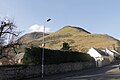
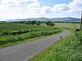
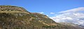
English: The Ochil Hills (from the Old Welsh uchel meaning 'high') is a range of hills in Scotland north of the Forth valley bordered by the towns of Stirling, Alloa, Kinross and Perth. The only major roads crossing the hills pass through Glen Devon/Glen Eagles and Glenfarg, the latter now largely replaced except for local traffic by the M90 Edinburgh-Perth motorway cutting through the eastern foothills. The hills are part of a Devonian lava extrusion whose appearance today is largely due to the Ochil Fault which results in the southern face of the hills forming an escarpment. The plateau is undulating with no prominent peak, the highest point being Ben Cleuch at 721m The south-flowing burns have cut deep ravines including Dollar Glen, Silver Glen and Alva Glen, often only passable with the aid of wooden walkways.
中文:奥克尔山(Ochil Hills)是一位於 苏格兰境內的山脉,地處福斯河之北,最高的本克鲁峰(Ben Cleuch)高721米。奥克尔山麓有杜拉、蒂利库特-{里}-、阿罗威、史特靈等四镇。名胜有十四世纪末建于杜拉山谷的坎伯古堡(Castle Campbell)。
mountain range in Scotland, UK  | |||||
| Upload media | |||||
| Instance of | |||||
|---|---|---|---|---|---|
| Location |
| ||||
| Mountain range | |||||
| Elevation above sea level |
| ||||
 | |||||
Subcategories
This category has the following 68 subcategories, out of 68 total.
A
- Alva Moss (3 F)
B
- Bengengie Hill (7 F)
- Bentie Knowe (3 F)
- Big Hunt Hill (5 F)
- Big Torry (1 F)
- Black Creich Hill (2 F)
- Burnfoot Hill (3 F)
C
- Cairnmorris Hill (3 F)
- Castle Campbell (102 F)
- Castleton Hill (3 F)
- Colsnaur Hill (9 F)
- Commonedge Hill (4 F)
- Core Hill, Perth and Kinross (4 F)
- Craig Leith (11 F)
- Craighorn (9 F)
E
- Elistoun Hill (2 F)
F
- Fin Glen, Ochil Hills (6 F)
G
- Glen Anny (4 F)
- Glen Sherup (7 F)
- Glenduckie Hill (11 F)
- Green Law, Perth and Kinross (2 F)
- Grodwell Hill (2 F)
I
- Innerdownie (18 F)
K
- Kidlaw Hill (2 F)
- Kinpauch Hill (9 F)
- Kirk Craigs (5 F)
L
- Little Corum (5 F)
- Lossburn Reservoir (7 F)
M
- Mickle Corum (8 F)
- Mid Cairn (2 F)
- Millar Hill (2 F)
- Myreton Hill (8 F)
P
- Pitcairlie Hill (3 F)
S
- Sauchanwood Hill (11 F)
- Scad Hill, Perth and Kinross (1 F)
- Scadlaw (2 F)
- Seamab Hill (21 F)
- Second Inchna Burn (3 F)
- Skythorn Hill (6 F)
T
- Tarmangie Hill (12 F)
- The Nebit (7 F)
- Turflundie Wood (11 F)
W
- White Creich Hill (4 F)
Media in category "Ochil Hills"
The following 40 files are in this category, out of 40 total.
-
 An Ochil Hills sunset - geograph.org.uk - 331900.jpg 640 × 427; 62 KB
-
 Bridge over the River Devon - geograph.org.uk - 412914.jpg 640 × 480; 145 KB
-
 Burnside, Dollar, Scotland-LCCN2001705970.jpg 3,655 × 2,728; 3.03 MB
-
 Dumyat from upper Alva.jpg 3,088 × 2,056; 1.06 MB
-
 Farm building in sunny Perthshire - geograph.org.uk - 685787.jpg 640 × 360; 54 KB
-
 Farmland - geograph.org.uk - 194322.jpg 640 × 480; 51 KB
-
 Fields looking toward the Ochils - geograph.org.uk - 85409.jpg 640 × 480; 80 KB
-
-
 General view, Dollar, Scotland-LCCN2001705969.jpg 3,636 × 2,747; 3.05 MB
-
 HFF in the Ochils - Flickr - jkiscycling.jpg 1,816 × 4,032; 1.58 MB
-
 In the Ochils - geograph.org.uk - 149743.jpg 640 × 481; 386 KB
-
 Inverness to Kyle Menstrie DMU230886 (16926429741).jpg 2,209 × 2,716; 3.97 MB
-
 Lane near Saline - geograph.org.uk - 10345.jpg 640 × 480; 89 KB
-
 New and old roads. - geograph.org.uk - 189055.jpg 640 × 480; 67 KB
-
 Ochil Hills - geograph.org.uk - 1564210.jpg 640 × 428; 40 KB
-
 Ochil Hills above Stirling - geograph.org.uk - 1564241.jpg 640 × 428; 66 KB
-
 Ochil Hills and statue of Robert the Bruce.jpg 3,648 × 2,048; 1.56 MB
-

-
 Ochil Hills, Blair Mains, Clackmannan.jpg 4,847 × 1,711; 1.5 MB
-
 Ochils2.jpg 1,792 × 1,200; 321 KB
-
 Ordnance Survey One-Inch Sheet 55 Perth & Alloa, Published 1957.jpg 8,321 × 9,985; 11.21 MB
-
 Ordnance Survey One-Inch Sheet 55 Perth & Alloa, Published 1969.jpg 8,421 × 10,004; 33.75 MB
-
 Ordnance Survey Quarter-inch sheet 7 Firth of Forth, published 1961.jpg 9,738 × 8,845; 10.16 MB
-
 Outh - geograph.org.uk - 284472.jpg 640 × 424; 42 KB
-
 Rennie McOwan climbing in the Ochils in Central Scotland..jpg 2,670 × 3,468; 2.5 MB
-
 Saline Golf Course - geograph.org.uk - 124241.jpg 640 × 480; 157 KB
-
 Seamab from the SW.jpg 3,088 × 2,056; 1.11 MB
-
 Smiles 1878 robertdickbaker00smil 0033 Ochils.jpg 2,010 × 2,956; 641 KB
-
 Smiles 1878 robertdickbaker00smil 0041 Dam's Burn.jpg 1,927 × 2,199; 418 KB
-
 Snow melt - geograph.org.uk - 147111.jpg 640 × 480; 88 KB
-
 Sun in the Ochils (Explored 13 05 22) - Flickr - jkiscycling.jpg 7,952 × 5,304; 41.44 MB
-
 Sunshine and shadow - geograph.org.uk - 147094.jpg 480 × 640; 78 KB
-
 The Ochil Fault - geograph.org.uk - 723997.jpg 640 × 433; 50 KB
-
 Touch Filter Station - geograph.org.uk - 184861.jpg 640 × 478; 108 KB
-
 Trig point, Ben Cleuch (Explored 10-08-22) - Flickr - jkiscycling.jpg 7,952 × 5,304; 4.97 MB
-
 Unidentified building - geograph.org.uk - 687871.jpg 640 × 360; 54 KB
-
 View over fields towards the Ochils - geograph.org.uk - 4052222.jpg 1,280 × 853; 904 KB
-
 Wallace Monument - Flickr - Graham Grinner Lewis.jpg 2,048 × 1,536; 562 KB
-
 West of Tarmangie Hill - geograph.org.uk - 3396086.jpg 640 × 427; 358 KB
-
 Wfm hillfoots scotland landsat.jpg 1,280 × 948; 423 KB


.jpg)


.jpg)


_-_Flickr_-_jkiscycling.jpg)


_-_Flickr_-_jkiscycling.jpg)


